


NSSL Research Efforts
One of the main weather research facilities in Oklahoma is the National Severe Storms Laboratory, which is one of the National Oceanic and Atmospheric Administration's internationally known Environmental Research Laboratories. These labs lead the way in investigations of all aspects of severe weather.
The NSSL is headquartered in Norman, Oklahoma, with staff in Colorado, Nevada, Washington, Utah and Wisconsin. In partnership with the National Weather Service, the people of the NSSL are dedicated to improving severe weather warnings and forecasts in order to save lives and reduce property damage.
The following is a sampling of the research efforts the NSSL is currently involved in.
Doppler Radar
Doppler Radar research began at NSSL back in the mid 1960's. During the 70's it was found that the Doppler Radar would greatly benefit the National Weather Service and could help to provide much improved severe thunderstorm and tornado warnings.
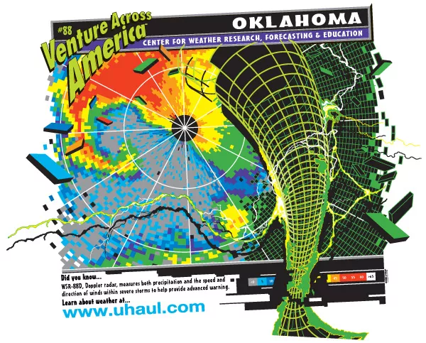
The new Radar, or NEXRAD for Next Generation Radar (officially WSR-88D), provides forecasters with a detailed look at storms through reflectivity and velocity displays. Reflectivity indicates rainfall or precipitation intensity and velocity displays the speed and direction of the winds within the storm. Through the Doppler Effect, a physical phenomenon marked by a change in frequency depending on the motion of an object toward or away from a point, the radar can give a picture of the winds within a storm. If, within a small area, high winds toward the radar are adjacent to high winds away from the radar, a circulation has developed and forecasters prepare to issue a warning. With this capability, tornado warning lead times have increased in the last 10 years from less than 5 minutes to nearly 12 minutes (NWS Office of Meteorology).
The National Weather Service's Doppler radar, the WSR-88D, has three parts: Radar Data Acquisition (RDA), Radar Product Generator (RPG), and Principle User Processor (PUP).
NSSL is now working to design and implement an open systems computing environment for these three functional areas of the radar. Scientists are also working to add polarimetric capability for future 88D upgrades.
Satellite
Satellites, primarily the Geostationary Operational Environmental Satellites (GOES), are critical tools for both forecasters and researchers. These satellites remain in orbit at a speed matching the Earth's rotation at a height of 35,800 kilometers. They provide measurements of cloud cover, both visible and infrared, and water vapor.
Research at NSSL is focusing on integrating satellite data into a mutli-sensor approach to the severe storm warning process. With radar and satellite combined, forecasters have a better look at how storms are evolving and which ones may become severe.
Software Development
Various groups within the Stormscale Research and Applications Division (SRAD) accomplish software development at NSSL. SRAD is dedicated to developing scientific tools that will help weather forecasters predict and detect all types of severe weather.
In working to understand the processes that produce severe weather, the attributes and capabilities of weather sensing systems, and the way in which forecasters use weather data, SRAD is working to build and test a number of prototype software algorithms and display systems. These scientific tools are then provided to the National Weather Service (NWS), the Federal Aviation Administration (FAA), and other groups that issue weather forecasts and warnings.
Numerical Modeling
With advances in computer technology, meteorologists have access to computer generated forecasts from numerical weather prediction (NWP) models. These complex computer programs mathematically describe the atmosphere's behavior, through physics and dynamics, and provide forecasts of temperature, pressure, moisture, rainfall, and winds. A forecaster examines the features predicted by the model to come up with a forecast for that day or several days.
There are many NWP models that describe the atmosphere. Each one uses a different calculation technique and performs these calculations at a certain spatial and temporal resolution.
Although models are extremely useful to forecasters, they are flawed in many ways. The equations used by the models to simulate the atmosphere are not precise and there are many gaps in the initial data from areas in the mountains or over the ocean.
Research at NSSL is focusing on new approaches for the use of NWP models in operational forecasting. This is accomplished by groups within the Mesoscale Research and Applications Division (MRAD) through an examination of:
- Higher resolution models
- Ensemble model forecasts
- Improved methods for the incorporation of observations
- Simulated hazardous weather events and their environments
Tornado
Tornadoes can occur in many parts of the world; however, they are most frequent during the spring in the central United States. Each year an average of 800 tornadoes are reported nationwide resulting in many deaths and injuries. Research at NSSL is focused on gaining a better understanding of tornado development and the environment in which tornadoes form. This is accomplished through theoretical studies, field programs, and radar algorithm development and testing.
The resulting knowledge and technology is then provided to the National Weather Service where it is put to use in the form of forecasts, watches, and warnings to the public.
Thunderstorm
Thunderstorms can occur anywhere in the world and at any time of the day. Across the globe nearly 1,800 thunderstorms are occurring at any moment (NOAA's thunderstorms and lightning... the underrated killers! Preparedness Guide).
All thunderstorms produce lightning and thunder, but have the potential to produce damaging straight-line winds, large hail, heavy rain and flooding, and tornadoes. A thunderstorm is classified as severe when it contains one or more of the following phenomena:
- Hail 3/4" or greater
- Winds gusting in excess of 50 knots (57.5 mph)
- A tornado
Research in this area at NSSL is focused on software applications and algorithms and various field programs to observe and understand thunderstorm initiation and structure.
Lightning
Lightning is the most dangerous and frequently encountered weather hazard that most people experience each year. It is the second most frequent killer in the United States with nearly 100 deaths and 500 injuries each year. (Floods and flash floods are the number one cause of weather related deaths in the US.) Using new knowledge about lightning, NSSL is leading an effort to collaborate with other groups to develop educational resources aimed towards informing the public of lightning hazards and improving planning for lightning avoidance. This is accomplished by:
- Developing climatologies that better define the lightning risk for several states
- Collaborating on guides and studies with the medical field
- And through papers, talks, posters, policy statements, and other educational materials
Winter Weather
Winter weather poses a great challenge to forecasters. From freezing rain to blizzards, winter events affects agriculture, transportation, utilities, businesses, schools, and can pose a great danger to the public.
Scientists at NSSL are looking to improve our understanding of hazardous winter weather. This is accomplished by groups within the Mesoscale Research and Applications Division (MRAD) through an examination of:
- The climatologies of winter weather patterns
- The structure and evolution of winter fronts and cyclones
- Improved forecasting techniques