



Marine Sanctuaries
National Marine Sanctuary Program
The National Marine Sanctuary Program was established under the Marine
Protection, Research and Sanctuaries Act of 1972. The mission is to
designate and manage areas of the marine or Great Lakes environment
of special national significance due to their conservation, recreational,
ecological, historical, research, educational, or aesthetic qualities.
Administration of sanctuaries relies upon effective resource protection,
educational, research, and enforcement programs. Sanctuaries, frequently
compared to underwater parks, are managed according to Management
Plans, prepared by the National Oceanic and Atmospheric Administration (NOAA) on a site-by-site
basis.
Since 1972, twelve areas have been designated as National Marine Sanctuaries, with another proposed for the year 2000:
Channel Islands
The Channel Islands National Marine
Sanctuary is located 25 miles (22 nautical miles) off the coast of
Santa Barbara, California. The sanctuary encompasses the waters surrounding
Anacapa, Santa Cruz, Santa Rosa, San Miguel and Santa Barbara islands,
extending from mean high tide to seven miles (six nautical miles)
offshore. The waters that swirl around the five islands within the
Channel Islands National Marine Sanctuary combine warm and cool currents
to create an exceptional breeding ground for many species of plants
and animals.
113 Harbor Way, Santa Barbara, Ca. 93109 (805) 966-7107
https://channelislands.noaa.gov/
Cordell Bank
About 52 miles (45 nautical miles) northwest
of the Golden Gate Bridge, at the edge of the continental shelf, Cordell
Bank rises from the seafloor. Over most of it, the water is about
200 feet deep. The site is a lush feeding ground for many marine mammals
and seabirds. Algae and invertebrates proliferate. Endangered humpback
whales along with Dall's porpoises, albatross, shearwaters, and countless
other marine species flourish in this extraordinarily rich marine
environment.
Fort Mason, Bldg. #201, San Francisco, Ca. 94123 (415) 561-6622
Fagatele Bay
Fagatele Bay National Marine Sanctuary
comprises a fringing coral reef ecosystem nestled within an eroded
volcanic crater on the island of Tutuila, American Samoa. This smallest
and most remote of all the National Marine Sanctuaries is the only
true tropical reef in the Program. Fagatele Bay provides a home to
a wide variety of animals and plants, that thrive in the protected
waters of the bay. The coral reef ecosystem found in the Sanctuary
contains many of the species native to this part of the Indo-Pacific
biogeographic region. Turtle, whales, sharks and the giant clam all
find refuge in this protected area.
P.O. Box 4318, Pago Pago, American Samoa 96799 (684) 633-7354
https://sanctuaries.noaa.gov/vr/american-samoa/fagatele-bay/
Florida Keys
The Florida Keys archipelago is known
world wide for its extensive offshore coral reefs. However, this sub-tropical
region also sustains many other interdependent habitats including
fringing mangroves, seagrass meadows, hardbottom regions, patch reefs,
and bank reefs. This complex marine ecosystem is the foundation for
the commercial fishing and tourism-based economies that are vital
to south Florida.
P.O. Box 500368, Marathon, Fl. 33050 (305) 743-2437
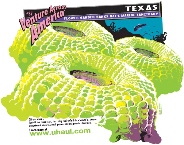
Flower Garden Banks
Flower Garden Banks National Marine
Sanctuary, located about 110 miles off the coasts of Texas and Louisiana,
harbors the northernmost coral reefs in the United States and serves
as a regional reservoir of shallow water Caribbean reef fishes and
invertebrates. The coral reefs rise to within 66 feet of the surface.
The Banks themselves are surface expressions of salt domes whose formation
began 160 to 170 million years ago in what was a shallow sea, subject
to evaporation. Today it has become a premier diving destination and
attracts scientists from around the world.
216 West 26th Street, Suite 104, Bryan, Texas 77803, (409) 779-2705
https://flowergarden.noaa.gov/
Gray's Reef
More than 14,000 years ago before
the retreat of the last Ice Age glaciers, enormous bison, camels and
mastodons roamed the rolling Georgia coastline, which extended 60
miles east of the current coast. This ancient coastline, now submerged
within the boundaries of NOAA's Gray's Reef National Marine Sanctuary,
still provides a healthy habitat for a wide variety of creatures albeit
less furry. Modern day Gray's Reef comprises one of the largest nearshore
sandstone reefs in the southeastern United States.
10 Ocean Science Circle, Savannah, GA 31411 (912) 598-2345
Gulf of Farallones
Just north and west of San
Francisco Bay a large expanse of Pacific Ocean along with nearshore
tidal flats, rocky intertidal areas, wetlands, subtidal reefs, and
coastal beaches were designated in 1981 as Gulf of the Farallones
National Marine Sanctuary. This 1,255 square mile area (948 square
nautical miles) is larger than the state of Rhode Island. The sanctuary
has thousands of seals and sea lions, and is home to the largest concentration
of breeding seabirds in the continental U.S.
Fort Mason, Bldg. #201, San Francisco, Ca. 94123 (415) 561-6622
Hawaiian Islands Humpback Whale
The waters around the main
Hawaiian Islands of Kauai, Oahu, Hawaii, Maui, Molokai, Lanai and
Kaho'olawe constitute one of the world's most important North Pacific
humpback whale (Megaptera novaeangliae) habitats and the only
place in the U.S. where humpbacks reproduce. Scientists estimate that
two-thirds of the entire North Pacific humpback whale population (approximately
4000-5000 whales) migrate to Hawaiian waters to breed, calve and nurse
their young.
726 South Kihei Rd., Kihei, HI 96753 (808) 879-2818
https://hawaiihumpbackwhale.noaa.gov/
Monitor
The Monitor National Marine Sanctuary protects
the wreck of the famed Civil War ironclad USS Monitor, best
known for its battle with the Confederate ironclad Virginia
in Hampton Roads, Virginia, on March 9, 1862. For over a century,
the Monitor lay undiscovered in 235 feet of water 16 miles
off Cape Hatteras, North Carolina. In August of 1973, scientists aboard
Duke University's research vessel Eastward located the Monitor
using sidescan sonar. The Monitor was placed on the National
Register of Historic Places in October 1974 as a resource of national
significance. In January, 1975, the Monitor became the first
National Marine Sanctuary.
The Mariner's Museum, 100 Museum Dr., Newport News, VA 23606 (757) 599-3122
Monterey Bay
The waters of Monterey Bay and the adjacent
Pacific Ocean off the central California coast were designated and
protected in 1992 as the Monterey Bay National Marine Sanctuary. This
vast area stretches 400 miles (348 nautical miles) north to south,
extends an average of 35 miles (30 nautical miles) offshore, and covers
over 5300 square miles (4,024 square nautical miles).
299 Foam Street, Suite D, Monterey, Ca. 93940 (408) 647-4201
Olympic Coast
The Olympic Coast National Marine Sanctuary
covers over 3300 square miles (2500 square nautical miles) of ocean
waters off Washington State's rugged and rocky Olympic Peninsula coastline.
Sanctuary waters extend an average of 35 miles (30 nautical miles)
offshore and span 135 miles (117 nautical miles) north to south, stretching
from United States/Canada international boundary to the Copalis River.
The sanctuary provides habitat for one of the most diverse marine
mammal faunas in North America, and is a critical link in the Pacific
flyway.
138 W. 1st Street, Port Angeles, Wa. 98362 (360) 457-6622
https://olympiccoast.noaa.gov/
Stellwagen Bank
The slow retreat of massive Ice Age
glaciers formed what is today Stellwagen Bank, a sand and gravel plateau
at the mouth of Massachusetts Bay. There, ocean currents sweep water
in and out of the bay, with the bank partially blocking the opening
and funneling the flow into relatively narrow passageways.
14 Union Street, Plymouth, MA 02360 (508) 747-1691
Proposed Sanctuaries
Thunder Bay
The waters of Lake Huron's Thunder Bay
in the state of Michigan are proposed for designation as a national
marine sanctuary in the year 2000. The region contains approximately
160 shipwrecks that span more than a century of Great Lakes maritime
history.
Regulated Activities
The Sanctuaries are treasures that belong to all of us. To protect the resources within the Sanctuaries for current and future generations, the following activities are regulated:
- Can't drill, mine, dredge, dump waste in or remove artifacts from a sanctuary
- Shipping is restricted to certain lanes to minimize the possibility of wrecks and spills
- Commercial fishing, diving for edible species and setting traps for crabs and lobsters are generally permitted
- Sportfishing, spearfishing, boating and other types of recreation are also generally permitted
Note: Spearfishing is NOT allowed in the Flower Gardens. And, only certain types of commercial gear are allowed.
For details regarding restrictions on the above activities, or to request permission to engage in a restricted activity, contact the Sanctuary office. Permission to engage in restricted activities will be considered on a case-by-case basis, taking into consideration the need for the activity, benefits expected to be gained and impacts to Sanctuary resources.
The National Marine Sanctuaries Program expands our nation's long history of protecting special areas on land to embrace the seas. It brings an ecosystem approach to marine environmental protection and asks us to adopt a new ethic of marine stewardship, but perhaps most of all, it challenges us all to work together to find creative solutions to the problems facing our oceans and coasts.